

Epic Roadtrip 2022 – Discovering the French Alps, Alsace and Jura
.png)
Introduction
For years our compass only ever pointed south east, towards Austria, Switzerland, Germany, and Italy. France, somehow, never made the list, an odd blind spot for a group this obsessed with driving roads. In 2022 we finally corrected it.
We weren't disappointed. Winding passes, picturesque mountain villages, endless open tarmac, France didn't just meet our expectations, it surpassed them. A reminder that sometimes the obvious choice is the one you keep overlooking, right up until you finally commit to it.
We assembled at Hotel Restaurant Saigon in Einöd, a district of Homburg in Germany's Saarland. From the outside it looked like a typical Gasthof tucked into the edge of the Palatinate Forest, though the name rather gave away what was waiting inside. The pairing was comical in the best way, a traditional German Gasthof fused with a Vietnamese restaurant, and the food was simply excellent. The right fuel for the miles ahead.
This trip was as much about positioning as driving. Rather than meandering up through northern France, where the roads are less inspiring, each of us made our own way south and east to Einöd, an efficient run with no pretensions of being a highlight. It simply put us in the right place to wake up to the real roads the next morning.
With everyone gathered and cars parked for the night, we called it early, knowing exactly what tomorrow would deliver.
Day 1: The Schwarzwald Beckons
Einöd sits right on the edge of the Palatinate Forest, close enough to the B48 that we were into proper driving roads within minutes of leaving the car park. The B48 is well known among German riders and drivers for the stretch through Johanniskreuz, one of the region's biggest biker meeting points, and for good reason: the road threads through dense forest with almost no straights, turn after turn without the long, dead sections that make other B-roads a chore.
From there we continued south to the B500, the Schwarzwaldhochstraße, 60km along the main ridge of the Black Forest between Baden-Baden and Freudenstadt. Built in 1930 specifically as a scenic route, it earns the reputation: long sweeping corners with real elevation change, views opening up over the Rhine Valley towards the Vosges on one side, and the Mummelsee, a glacial lake wrapped in local legend, along the way. It's also known for fog rolling in without warning, even in summer, which keeps you honest.
The final kilometres brought us into Thann, France. Our hotel, Hôtel Restaurant Le Moschenross, a 19th century building run by the Pontal family since 2000, sits right at the start of the Alsace Wine Route, facing the Rangen vineyard. There was no dinner to be had that night, so we took to Thann's streets instead, local takeout eaten under the stars, engines cooling beside us.
Route facts: Einöd (Homburg), Germany to Thann, France · 389 km · B48, Schwarzwaldhochstraße (B500)
Day 2: Into the Vosges, with a Quintessential French Surprise
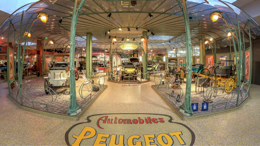
Before the driving began, a detour to the Musée de l'Aventure Peugeot in Sochaux, built inside a former brewery on the edge of Peugeot's own factory site. It opened in 1988 and now holds well over a hundred vehicles, but the real surprise is everything else Peugeot has made since 1810: bicycles, sewing machines, tools, and coffee grinders. Almost everyone in our group left with a pepper mill, an unplanned but oddly fitting souvenir.
With the museum behind us, we picked up the Route des Crêtes, one of France's great driving roads. It was built as a military supply route during the First World War, out of necessity rather than tourism, which is exactly why it works so well today: no detours for scenic viewpoints, just a direct ridge line with sweeping curves and uninterrupted views over the valleys either side.
Partway through, a stop at Hartmannswillerkopf, known locally as Vieil Armand. This was one of the most brutal battlefields of the First World War, an estimated 25,000 French soldiers died fighting for this single peak in 1915 alone. Forty five kilometres of preserved trenches remain, among the best kept battlefield remnants in France, alongside the national monument inaugurated in 1932. A sobering stop between two stretches of driving that otherwise asked nothing of us but enjoyment.
Back on the road, we picked up the Col de la Schlucht, then Col du Bonhomme, then Col de la Grosse Pierre, each a different flavour of Vosges tarmac, before the mountains gave way to the rolling foothills of eastern France.
The day ended at Auberge de la Rivière in Foncine-le-Haut, on the banks of the Saine river at the gateway to the Haut-Jura. A small, family run inn with genuinely good food, the perfect way to wind down after a day that mixed full throttle driving with a reminder of what these mountains have seen.
Route facts: Thann, France to Foncine-le-Haut, France · 392 km · Musée de l'Aventure Peugeot, Route des Crêtes, Hartmannswillerkopf
Day 3: Climbing to the High Alps
Leaving Foncine-le-Haut, the transition from rolling hills to full Alpine scenery happened fast. The first challenge was the Col du Grand Colombier, one of the toughest passes in France, with stretches over 20% on its steepest side, tight enough that you're dropping two gears at a time and riding the brakes into some of the hairpins. Empty roads meant we could actually use the whole width of the tarmac.
The road carried us past Lac du Bourget, its deep blue water sitting against the jagged peaks on the horizon, before the Col du Télégraphe set up the day's main event: the Col du Galibier. At 2,642 metres it's one of the highest paved roads in the Alps, first opened to traffic in 1911, the same year the Tour de France crossed it for the first time. Steep, narrow in places, and constantly demanding, but the summit view makes every metre of climbing worth it.
The descent onto the Col du Lautaret was fast and flowing by comparison, a route used since Roman times and part of the wider Route des Grandes Alpes. From there into Le Monêtier-les-Bains, the road opened into long, easy curves, the perfect cool down after a full day of mountain driving.
Tonight's stop, Hôtel Le Monêtier, was a genuine surprise: a proper 4 star property with a restaurant terrace facing the glacier, more luxury than any of us expected from a mountain village hotel. A well earned moment of relaxation after a relentless day of Alpine tarmac.
Route facts: Foncine-le-Haut, France to Le Monêtier-les-Bains, France · 442 km · Col du Grand Colombier, Col du Télégraphe, Col du Galibier, Col du Lautaret
Day 4: The Southern Alpine Attack
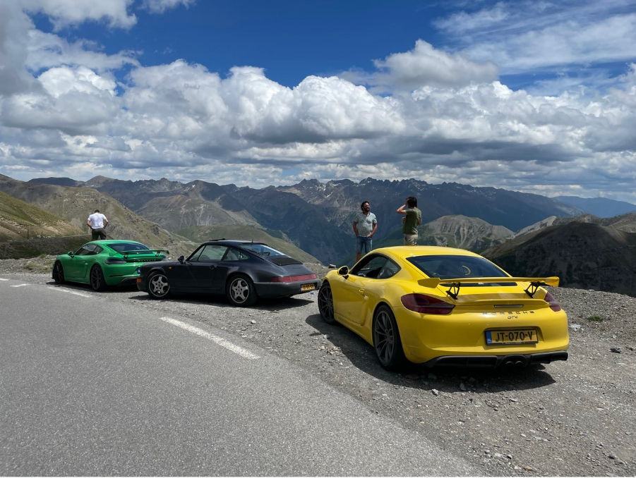
Leaving Le Monêtier-les-Bains, the terrain turned wilder and more exposed heading south. The morning was dominated by the Col d'Izoard, a pass that feels like it belongs on another planet: the Casse Déserte section near the summit is a genuine lunar landscape of bare rock spires, the current road built between 1893 and 1897 by the French army. Steep and demanding, but the surface is good enough to trust fully through every switchback.
Next came the Col de Vars, a different kind of challenge entirely, wider and faster, encouraging a higher speed attack where the cars could properly stretch their legs through long sweeping corners.
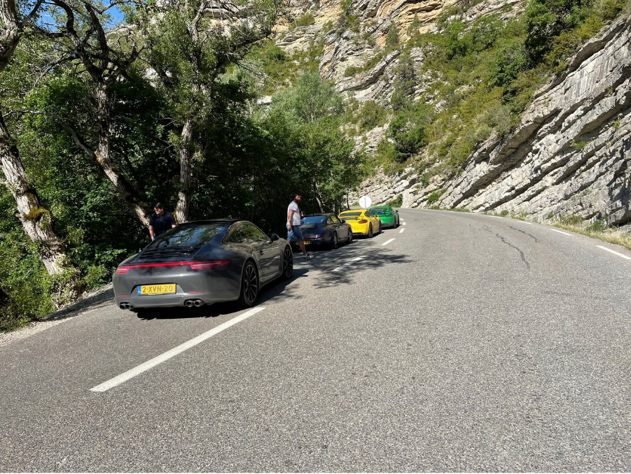
Further south we skirted the Gorges du Verdon, France's answer to the Grand Canyon. The road itself is the real story here: 22 kilometres cut into the cliff face, a drop of more than 700 metres in places, sections too narrow for two way traffic and no guardrail. Balancing the view with the cornering line took real concentration.
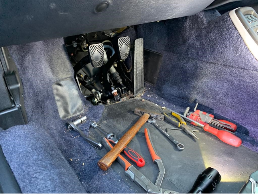
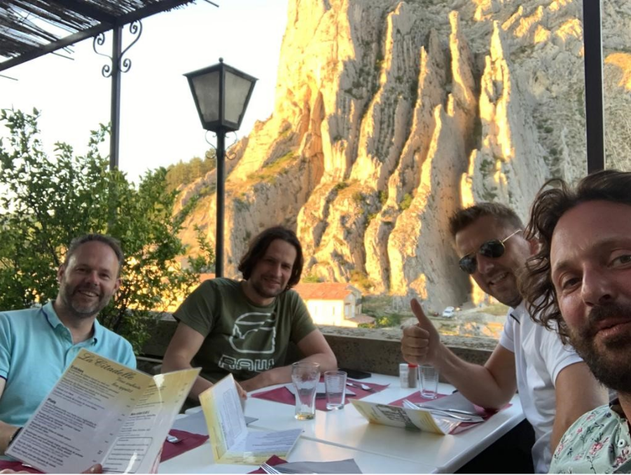
The day ended on the Route Napoléon, the road Napoleon himself took in 1815 on his return from exile on Elba, now regarded as one of the best drives in France. High speed sweepers, elevation changes, and cambered tarmac all the way into Sisteron, where we settled into Hôtel Restaurant de La Citadelle, arriving with the clutch pedal of a Porsche 964 on its last breath, a pin having worked itself loose. Everyone pulled tools out of their own cars and we spent a hot, cramped hour in the car park getting it sorted before we could even think about checking in.
The location is genuinely excellent, right beneath the citadel with a terrace over the Durance, but the hotel itself doesn't go much beyond that. It did the job for a night's stay, nothing more.
Route facts: Le Monêtier-les-Bains, France to Sisteron, France · 392 km · Col d'Izoard, Col de Vars, Gorges du Verdon, Route Napoléon
Day 5: Through the Vercors, Where Roads Defy Gravity
Leaving Sisteron, the landscape shifted from rolling foothills to dramatic rock faces. Mont Ventoux loomed on the horizon, tempting as a detour, but today's focus was different: hidden mountain passes and cliffside roads.
The first major highlight was Col de Rousset, a genuine driver's road, long flowing sweepers, sharp elevation gains, and a series of tunnels punched straight through the rock. The descent was just as good, tight technical switchbacks dropping into the Vercors Massif.
Then came Combe Laval, which isn't just a road, it's an engineering marvel. Built between 1861 and 1898, it hugs the edge of sheer cliffs, with tunnels and overhangs framing the view, a low stone wall the only thing separating the tarmac from open air the entire way.
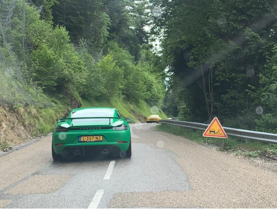
Then gravillon struck. It's a resurfacing technique, fresh asphalt sprayed with binder and then covered in loose chippings that traffic is supposed to bed in over the following days, and it turns an otherwise perfect road into a nightmare for anything low and fast. The cars on carbon ceramic brakes suffered worst. With so little clearance between caliper and wheel, a stone finding its way in there is close to guaranteed, and once it does, it etches grooves straight into the wheel. I've stopped fighting it at this point. On the GT4 I just call it patina and wear it with some pride.
We finished the day in Bernin, at Domaine des Fontaines, not the most luxurious stop but exactly where we needed to be. Solid, straightforward, the kind of hotel that does the job without pretending to be anything else. The food was good, and after a day like this, nothing else really mattered.
Route facts: Sisteron, France to Bernin, France · 446 km · Col de Rousset, Combe Laval, Vercors Massif
Day 6: From the Alps to the Jura
This was the day we all dread just a little, the one where the compass quietly swings north and starts pointing home. Reality is out there waiting, and there's no outrunning it forever. With the Vercors in the rearview mirror, the route ahead led towards the Jura, a region often overlooked but packed with good driving roads: tight technical passes, open flowing sections, and a high speed run along a lakefront.
The first climb was Col du Granier, a narrow, twisting ascent through dense forest. The hairpins came thick and fast, demanding precision, but the reward was an open descent with wide sightlines and cambered corners.
Approaching Lac du Bourget, the character of the road changed entirely, smooth, fast, rolling alongside the water, every curve feeding into the next.
Further north, the Col de la Faucille opened into long sweepers and panoramic straights, with Mont Blanc visible on the horizon and, on a clear day, Lake Geneva laid out below.
We finished the day in Ornans, at La Table de Gustave, a hotel and restaurant named for the town's most famous son, the painter Gustave Courbet, right on the banks of the Loue with his museum a few minutes' walk away. Over dinner we ate freshly caught trout, straight from the river the hotel sits on. A welcome contrast to the previous night, genuinely good food and a sense that the journey was nearing its end.
Route facts: Bernin, France to Ornans, France · 430 km · Col du Granier, Lac du Bourget, Col de la Faucille
Day 7: From the Jura to the Schwarzwald
Leaving Ornans, the morning wound through the last remnants of the Jura, but the real focus was further ahead: the return to Germany via the Vosges.
The first challenge was the Ballon d'Alsace, at 1,247 metres. It holds a genuine piece of cycling history as the first mountain the Tour de France ever climbed, back in 1905, though what matters more from behind the wheel is the tight, technical ascent giving way to open views at the summit, and a descent of well cambered switchbacks that reward a well placed throttle.
Further north we picked up Col de la Schlucht again, faster and more flowing this time, carving through thick forest before the landscape flattened out towards the Alsace plain and the German border.
Then Germany welcomed us back with the B500, the Schwarzwaldhochstraße, for one last run. The perfect way to close the day, long sweepers, elevation changes, and tarmac that keeps rewarding you right through the Black Forest.
We finished at Grüner Hof in Zell am Harmersbach, a family run Gasthof that's been in the same family since 1838. Fittingly, given the previous night's trout dinner in Ornans, the house speciality here is also fresh trout, alongside its own home cured meats and schnapps. Schnitzels and Weizen beers were the right way to reflect on the miles behind us and the final stretch still ahead.
Tomorrow we'd enter our home addresses into the sat nav and go face reality, but this trip would keep us fuelled up until the next one.
Route facts: Ornans, France to Zell am Harmersbach, Germany · 379 km · Ballon d'Alsace, Col de la Schlucht, Schwarzwaldhochstraße
Day 8: The Final Stretch
The last day started in Zell am Harmersbach, deep in the Black Forest, with one final chance to enjoy some of Germany's best driving roads before the long push home.
The morning gave us a proper send off along the last sweepers of the Schwarzwaldhochstraße, the road that had opened this whole trip back on Day 1, long flowing curves and tree lined horizons, one final taste of proper driving before reality set back in.
Then the mountains faded from the mirrors, replaced by the flat efficiency of the Autobahn. No detours left to take, just the satisfaction of the last drive and a warm meal waiting at home.
The trip was over. But the roads? They never really end.